 After a rough week that included some difficult deliveries, (another) bout of food poisoning, and unrelentingly heavy rain; Markus and I took advantage of a clear day and hiked the National Park of American Samoa Mt. Alava trail.
We’d tried this hike shortly after we got here and of course didn’t bring enough water. We turned back after getting (we now know) ¾ of the way to the end of the trail.
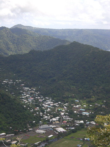
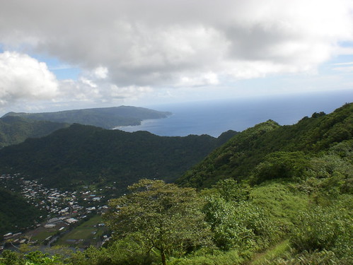 American Samoa is described in travel guides as a “serpentine” island. I had no idea what this meant until I got here. Now I think of the island as a giant sleeping dragon in the ocean, its jagged back creating a mountain range down the center of the curving island. The park follows this ridge through the rainforest and shows glimpses through dense foliage of the east side of the island—a side rarely seen as the only main road follows the opposite side of the island.
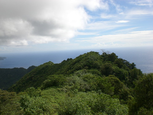 The trail is unrelenting, following the ridgeline in it’s ups and downs, as if you were walking up and down the spines of the dragon I described earlier. It was a really gorgeous day—cooler than usual having been raining so much, but the skies were clear blue and there was low humidity.
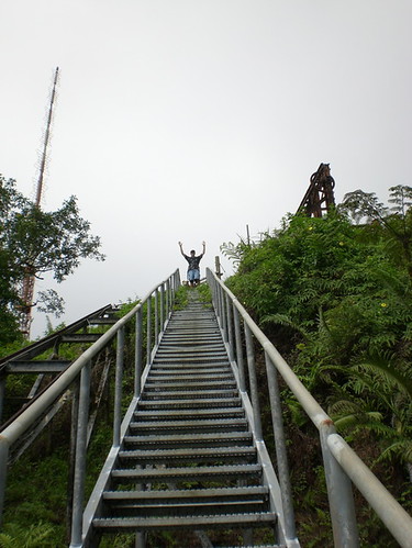 We made it to the end of the trail which is the abandoned remains of a cable car that was originally installed for maintenance of the radio towers on the mountain.
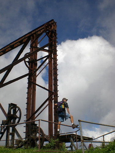 The cable car was decommissioned in the 90s (I think) when two jets peforming flying demonstrations during a celebration ran into them, sadely killing the pilots.
 There is also a nice fale to rest in and (had we been better outfitted) eat lunch.
The view from up here is fabulous—you can see
Pago Pago
IBM Beach
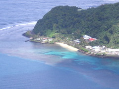
Rainmaker Mountain
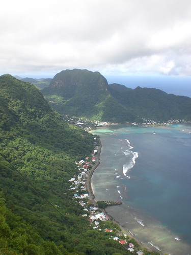
The Harbor
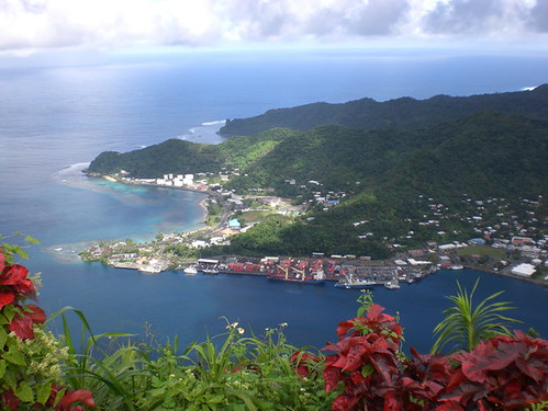
Our house

 The mountainside is just beautiful. Tree ferns, flowers, banyon trees. There are few critters up there but you do see doves, lizards and some pheasant type of bird that Einstein likes to chase.
 The trail is very muddy and slippery as it always rains here, especially in the mountaintops. Markus almost wore his Tevas but luckily with a weary “yes, dear” “changed” his mind.
Overall the hike took us 3 ½ hours with a ½ hour rest brake at the fale.
 There’s a continuation of the trail from the fale down the other side of the mountain to Vatia. Apparently, some people walk one way to Vatia and then are met by friends or take a bus back. I think this will be our next approach to the trail.
There are more photos on my Flickr account if you'd like to check them out.

No comments:
Post a Comment