
This is a map of our island
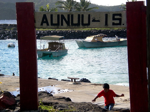
Tutuila and off in the upper right hand corner is the island of '
Aunu'u. It's a 20 minute boat ride from the small harbor at the tip of the island.
We hadn't explored '
Aunu'u yet so the last two Saturdays we ventured out to discover this lovely island.

Families commute between '
Aunu'u and
Tututila everyday. Taking the boat in to
Au'asi and then
busing or for the, lucky, driving into work. One way the boat trip is $1. It's well worth it. There are one or two vehicles on the island for the power company I think. Everyone walks on '
Anuu'u. People have to bring in their groceries by boat. I think this leads to a much healthier lifestyle here than on
Tutuila. Less
SUVs and
MickeyDs is better for everyone.
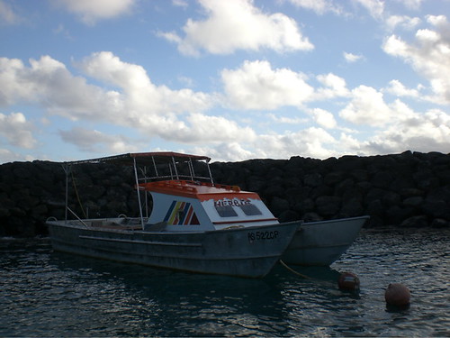
I haven't been on a boat bigger than my kayak since we got here and I thoroughly enjoyed it. The first Saturday we went out, there was a high surf and high tide and the waves were rocking and rolling. Markus was a little concerned with the possibility of seasickness but he did quite well. Here's an example of the boats you travel on-this is Herbie named after the famous
VW Bug after it's '70s
paintjob.
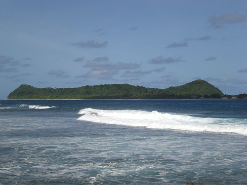
Despite the waves the day was fantastic. We went with a few friends who had been there before. The waves were too strong for swimming on the beach, but the harbor is incredibly clean and was fun to swim in with the giant swells rolling in. The dock is also fun for jumping and diving. Local kids fling themselves down the boat ramp like a very dangerous version of a slip and slide-which despite the risk of
concussion looks very fun.
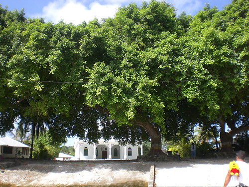
The next weekend we headed back out to the island for more of a hike. We basically
circumambulated the island. Here is the lovely view as you come into the harbor. A beautiful church framed by ancient
Banyon trees.
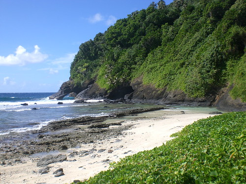
We started at the harbor again and walked a short distance to the north (left from the harbor if you are planning on doing this hike) to a lovely cove of white sand with a small pool protected by the reef.
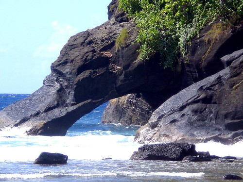
The tip of the island ends here in a lovely natural volcanic arch. From here you walk straight through the center of the island on a two track dirt road.
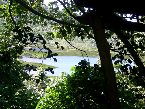
It shortly ended at a four track crossroads. On the left were two trails that wrap around Red Lake, to the right the trail goes back down to the village through the forest and then the south coast. You can see the lake through the trees at the top of this hill. That's pretty much the last you'll see of it. We chose the right hand path around the lake. You follow a VERY muddy road down into the forest.

Strangely there is a refrigerator, legless chairs and a few other household items set up in the jungle as if someone just ran out for a minute. If you follow this road all the way to the end it leads to the island's dump. My hunch is that someone just didn't make it down the treacherous road far enough and
unfortunately decided here was as good of a place as any to rid themselves of some garbage.
One follows the road down until it starts to veer to the right (but don't go that way-it's the dump). Stop where you are and turn to your left and look into the jungle. Now you'll see it. There's an overgrown road that circles the lake here. You will know you're in the right spot because you can hear the surf crashing on the cliffs at
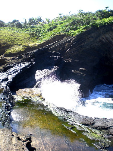
Ma'ama'a Cove that you'll find by following this path.

The scenery here is very dramatic. The whole area looks like someone took a scoop out of the coast. There are amazing tidal pools with whole schools of fish. However it is unwise to get close as the waves come crashing all the way up the cliffs unexpectedly and you could find yourself swept over the side with really no hope of rescue. The books say this is the legendary site of the famous
Sina and
Tigila'u-shipwrecked lovers. There is a Samoan dance for
Sina that I've semi-learned in my dance class! We looked for a way to the lake on our way back to the road, but to no avail. The area is just too thick with mangrove.
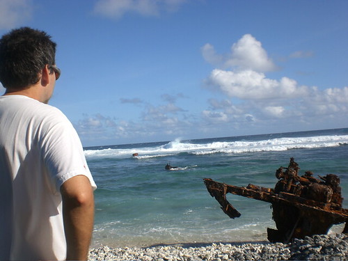
So we headed back up the hill to the crossroads. We rested here a bit then headed back down to the village. The coastline here is large rocky beaches and tidal pools. I love these areas as they are great for seashells. There is a dramatic scene with a very rusted out ghost of a WWII ship. If you squint you can see her original length and
breadth but now she is just rusty segments, part in the water, part on land.

If you continue around the island back towards the harbor you'll find some lovely stretches of white sand beach. It was low tide so the swimming wasn't that great and I'm not too sure how good it would be if it was high tide.

But still,
pristine swaths of white sand are hard to come by in American Samoa.
We jumped into the harbor and swam a bit. This time the harbor was calm and clear. The water in the harbor a bright
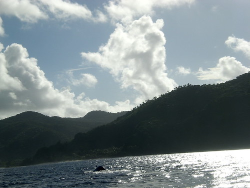
turquoise. We caught one of the last boats back (I'm told the last is 4pm but I never confirmed this with a boat driver). On the way back to make the day truly amazing, a whale crossed directly in front of the boat. The driver killed the engine to our mixed cries of "Whale!" and Samoan,
"Tafolà!". You can see a tiny bit of whale here in this not so fabulous photo.

If '
Anuu'u wasn't such a commute-this is
defiantly where I would love to spend the rest of my days in American Samoa. Seeing
Tutuila from this vantage point makes it seem like I truly am living in paradise.
 This is a map of our island Tutuila and off in the upper right hand corner is the island of 'Aunu'u. It's a 20 minute boat ride from the small harbor at the tip of the island.


